|
|
Home >
Weather >
NZ Weather
 National Weather Summary
 |
| Wellington |
| Today |
 |
Hi:
Low:
 |
19°
14°
15 |
Wind with 15kph NNE winds
|
|
|
|
For detailed forecast click here
|
|
 |
Move your mouse pointer
over towns for local
forecasts & click for details |
|
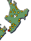 |
 
Click above for North
& South Island Weather |
| Tomorrow |
 |
Hi:
Low:
 |
19°
14°
|
| Fine |
|
|
| Tuesday |
|
Hi:
Low:
|
20°
13°
|
Fine
|
|
|
|
|
| National Short Range Summary |
|
|
Gisborne, Hawke's Bay, Wairarapa and Wellington
Cloud increasing this morning. Scattered rain developing this afternoon.
Remainder of the North Island
Cloud increasing early, with periods of rain from late morning, possibly heavy with thunderstorms later.
Marlborough, Nelson and Buller
Cloudy. Rain developing this afternoon, some heavy. Possible thunderstorms in the west. Rain clearing late evening.
Grey, Westland and Fiordland
Periods of rain, becoming persistent and heavy, with possible afternoon thunderstorms north of Fiordland. Rain easing this evening.
Canterbury
Cloud increasing this morning. Scattered rain from afternoon, then clearing this evening.
Otago and Southland
Periods of rain, becoming widespread and heavy for a time in Southland and Clutha.
Chatham Islands
Low cloud and occasional drizzle. A few fine breaks this afternoon.
click here for your national text summary and Long Range Forecast
|
Data is for information only. New Zealand City disclaims all liability or responsibility for any loss or damage that may result from the
action or failure to act by any person in reliance on any information provided herein.
All content © 2025 NZCity Ltd, data © 2025 MetService and other providers.
|
|
|